
In this article I will cover the best cheap hiking GPS you can currently buy. If you are looking for a handheld GPS that needs to be both very reliable and be affordable, you have come to the right place
When hiking, having a GPS is pretty important because you want to know where you are at all times. However, what I find even more important is that it gives you some peace of mind. You always have something to rely on in case you get lost, just don’t forget to bring enough batteries!
Garmin eTrex 10
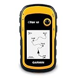
Lets first start off with the low cost Garmin eTrex 10 Worldwide Handheld GPS Navigator (though for simplicity reasons we will from now on be referring to it as “Garmin eTrex 10”). First of all, the Garmin eTrex 10 is a cheap and reliable hiking GPS, which is wonderful for anyone who wants to get into hiking without splashing too much cash.
Next, let’s look into the Garmin eTrex 10’s most important features.
A small, yet comfortable 2.2 Inch monochrome display is what is used to show the picture on this GPS, though it may not look pretty, it is practical and that’s the one thing you need with hiking, practicality. The display can be read in any lighting situations, unlike something like an OLED screen. Don’t let looks deceive you, the screen in the eTrex 10 is built for durability.
The interface itself is easy to use, which is good for the non-technical people among us and those who just want to jump straight into a hike. Though the resolution and amount of pixels is obscenely low compared to, let’s say, a sat-nav or a smartphone, it is done for a reason, as the eTrex 10 can last a long time on just one battery before it needs to be replaced, which is useful for a long hike.
Of course, however, there are downsides, mainly being this GPS’s small cache memory which means it can’t display maps larger than an English county and to get firmware updates you must buy a MicroSD with it on from Garmin.
That being said, it is one of the cheapest handheld GPSes that you can buy today. On top of that, it’s both reliable and durable, this makes it a very solid option for any hiking trip.
If you consider buying this product, the lowest price can usually be found on amazon: Garmin eTrex 10 Worldwide Handheld GPS Navigator
Tip: consider buying a screen protector – and maybe even a carrying case as well.
Garmin eTrex 30x
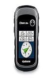
The Garmin eTrex 30X, is one of the most used Garmin GPS devices. Though it may seem pricey compared to the eTrex 10, there is a reason for that. That is because it has a plethora of more features than the eTrex 10 and has upgraded basically everything from the eTrex 10. Let’s get into what’s new and what’s different!
First of all, despite still being 2.2 inches, the display is miles better than the eTrex 10. With this device having a colour display which is also bright.
The eTrex 30x comes preloaded with the Topoactive map of Western Europe which has thousands of cycle trails and hike trails available to you from the click of a button.
This portable GPS comes with an in-built electronic compass, barometric altimeter, and the ability to transfer data wirelessly with similar devices. These are all features the 10X does not have.
It also has a huge battery life of approximately 25 hours and also has excellent GPS tracking software, in which it claims can get your location almost instantly.
So the eTrex 30X is basically the upgraded version of the eTrex 10X. So, is it worth it? Well, it really depends whether or not you need the additional feature and whether or not you are willing to pay slightly more for it.
The 30x is still a cheap hiking GPS, but it’s not a “bear minimum” product, so you will find cheaper products out there.
If you still have some money left I would also suggest to buy a screen protector and maybe even a carrying case. It might save you money in the long run 😉
For more information, feel free to take a look on amazon: Garmin eTrex 30x
Bushnell Bear Grylls Edition
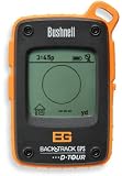
The Bushnell Bear Grylls Edition, is similar to the eTrex 10, however, it does have a few advantages and disadvantages over it. Let’s look at the features and see what you can get from the Bushnell!
First of all, the Bushnell Bear Grylls Edition tracks the time, temperature and altitude of your trip, which allows you to marvel at the statistics of the route you where taking and allows you to see just how cold it got on your trail.
The screen is a downgrade from the eTrex 30X, however, this isn’t really a fair comparison since the eTrex 30X is quite a bit more expensive. The screen the Bushnell uses is a non-colour grayscale LCD screen. The Bushnell claims to be weather-proof, which is highly recommended for a hiking GPS – yes even for a cheap hiking GPS.
It also can record a map of the route you took, including the times of when you were at certain places. This is very useful if you want to list your trails and see in the future the trails you used to take and how much time it took you to do them. Along with them, it has all the features that the eTrex 10 had, making this most likely the more worthwhile purchase. That being said, it kind of depends whether or not some products are on sale, but often the eTrex 10 can be bought for a slightly better price.
If you want to check the latest price, take a look on amazon: Bushnell Bear Grylls Edition
Garmin Oregon 650t
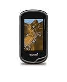
Our final GPS, yet the third GPS from Garmin, is the Garmin Oregon 650t, which we will be referring to as the “Garmin 650t” from now-on. It is the most expensive on this list. However, the features once again make up for the price.
This is easily the largest display out of all the GPS we have seen yet, the Garmin 650t sports a three-inch, useable in all light situations, touchscreen display. This allows for ease of accessibility making your hikes using this device all the easier.
The Garmin 650t is also the only device out of all the devices on this list to sport a camera, and a rather good one at that, having 8MP camera quality, your GPS will provide the same picture quality as a lower-middle end mobile phone. Now that is impressive, meaning you can not only track your hikes route but also take pictures of it!
The 650t also includes all the basics found in the other GPS on this list.
Once again, for more information or the latest price, you can consult amazon: Garmin Oregon 650t
Consider a GPS with emergency signal
I wanted to point out that none of these GPSes that I mentioned so far can send an emergency signal. If a GPS can do it, it enters a new price class and it’s called a personal locator beacon GPS (or something similar).
I realize, you care about your budget, so you probably don’t want to spend too much money. However, it could literally save your life one day, so I at least wanted to mention my top 2 picks when it comes to cheap personal locator beacon GPS:
I’m not going to go too in-depth, simply know that these are some of the best value for money you are going to get when looking for a GPS that can also send and emergency signal. You can always find more information on amazon, -or simply contact me- if you have any more questions.
Conclusion
This was my take on the best cheap handheld GPSes that are solid options for hiking after hours of research. I focused on price (obviously), durability, battery duration and features.
If you are looking for something very cheap but very basic, simply look at the Garmin eTrex 10. If you do care at least a bit about features -but you are still on a budget- you should take a look at the other options on the list.
Garmin is obviously one of the best brands to go with when looking for a cheap handheld GPS. However, their customer service -sadly- is pretty bad, so keep in mind that decent customer service is not included in the price.
Have you used any of these GPSes on one of your hiking trips? Do you have any other recommendations? Please let me know in the comments below, I always appreciate input/feedback!