Best Satellite Phone for Hiking: Full Buyer's Guide 2026
Choosing the best satellite phone for hiking in 2026. Compares satellite phones, Garmin inReach communicators, and PLBs with subscription costs.

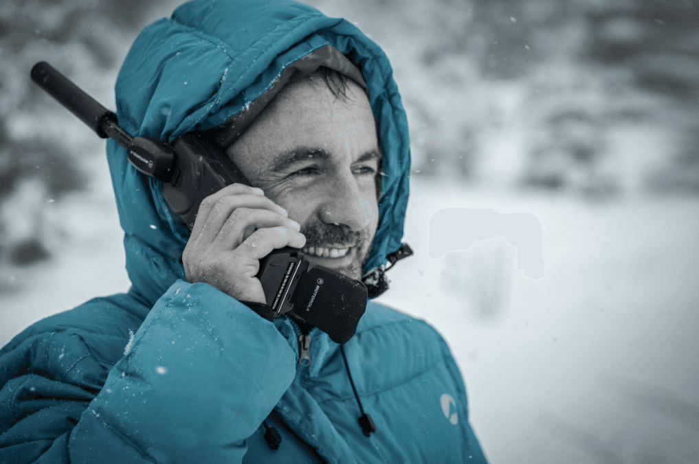
Most hikers who search for "satellite phone for hiking" don't actually need a satellite phone. What they need is a satellite communicator, and the difference matters a great deal, both for your wallet and for how useful the device will be in an emergency.
This guide covers the full range: true satellite phones, two-way satellite communicators, and personal locator beacons. It explains which category fits which hiker, gives you the actual subscription costs, and tells you which specific devices are worth buying in 2026.
Which Device Do You Actually Need?
Before looking at individual products, it helps to understand the three categories. Plenty of people spend hundreds more than they need to, or buy the wrong type entirely.
Personal locator beacon (PLB): One-way only. When activated, it sends a distress signal via the COSPAS-SARSAT government satellite network. No subscription fee. No two-way communication. No location tracking. The right choice if your only goal is emergency-only signalling at the lowest ongoing cost.
Satellite communicator: Two-way text messaging, GPS tracking, SOS with monitored response, weather updates. Can't make voice calls. Requires a monthly or annual subscription. The right choice for most hikers, from day walkers to multi-week expeditions.
Satellite phone: Full voice calls over satellite networks, plus SMS and basic GPS. Heavy, expensive to buy, expensive to run. The right choice for expedition leaders, commercial guides, or anyone who specifically needs to make phone calls.
Best Satellite Communicators for Hiking
This category covers the devices most hikers should buy. All use the Iridium or Globalstar network for global or near-global coverage.
Garmin inReach Mini 2: Best Overall
The Garmin inReach Mini 2 is the straightforward top pick for most hikers. It weighs 100g, runs on the Iridium satellite network (genuine global coverage including both poles), and fits in a jacket pocket.
What you get: two-way text messaging, real-time GPS tracking with a shareable live link for family at home, SOS with 24/7 monitored response from the Garmin Response coordination centre, and weather forecasts sent directly to the device. You can also pair it to your phone via Bluetooth to type messages on a proper keyboard rather than navigating a tiny screen.
The subscription options that matter most for hikers:
- Safety Plan ($25/month): unlimited tracking, 40 messages, SOS. Enough for most trips.
- Freedom Plan ($15/month + message costs): lower baseline, pay-per-message. Works well if you hike a few times a year and suspend between trips.
- Seasonal activation: pause and resume month-by-month. You only pay for the months you actually hike.
At 100g and $250 for the device, it sits at a fair price for the capability. It's the most capable device in its weight class, and the subscription cost is reasonable for what you get. The two-way messaging alone makes it worth the inReach over a PLB: you can tell rescue services "I've broken an ankle, I can walk slowly, please send a vehicle to the trailhead in four hours" rather than simply triggering an alarm and waiting.
For details on how satellite coverage actually performs in different terrain, see our guide to where satellite phones work.
Garmin inReach Messenger: Best for Budget-Conscious inReach Users
The inReach Messenger is the newer, cheaper Garmin communicator at $300. It's slightly heavier than the Mini 2 (115g) but adds a practical LED safety light and an improved front display. The satellite connectivity is the same Iridium network.
The Messenger cuts some features from the Mini 2: no dedicated barometric altimeter or compass, slightly reduced battery life. For hikers who primarily want SOS plus occasional tracking and messaging, the Messenger delivers the same core capability at $50 less.
SPOT X: Best Budget Two-Way Communicator
The SPOT X uses the Globalstar satellite network and costs $150 for the device, with subscriptions from $11.95/month. That's a meaningful cost reduction versus the inReach.
The trade-off is coverage. Globalstar has some equatorial gaps and reduces in performance above approximately 70° latitude. For hiking in most of Europe, North America, and temperate regions, the coverage is adequate. For Scandinavia, Alaska, Iceland, and high-latitude destinations, the SPOT X is less reliable than an inReach.
If your hiking is in well-covered regions and budget is the primary concern, the SPOT X is a reasonable choice.
Satellite Communicators for Hikers
Garmin inReach Mini 2
$250 + from $15/month
?Estimated price — check latest price on Amazon
Best all-round satellite communicator for hiking
Pros
- ✓100g, the lightest full-featured communicator
- ✓Iridium network: genuine global coverage
- ✓Monitored SOS via Garmin Response 24/7
- ✓Two-way messaging, tracking, weather
- ✓Seasonal plan suspension available
Cons
- ✕Device costs $250
- ✕Subscription required ($15-25/month)
- ✕Small screen, fiddly to type on
SPOT X
$150 + from $11.95/month
?Estimated price — check latest price on Amazon
Best budget communicator for most hiking regions
Pros
- ✓Cheaper device ($150)
- ✓Lower subscription cost ($11.95/month)
- ✓Two-way messaging and tracking
- ✓Good coverage in temperate regions
Cons
- ✕Globalstar network: gaps in high latitudes
- ✕No weather forecast integration
- ✕Heavier than inReach Mini 2 (142g)
Best Personal Locator Beacons
A PLB is the right tool for hikers who want emergency-only safety cover with no ongoing subscription costs. You register the device once (free), and it transmits your location to coordinated search-and-rescue services when activated.
PLBs use the COSPAS-SARSAT network, a government-operated system used by rescue services in over 40 countries. There's no company-operated monitoring centre. When your PLB goes off, the signal reaches maritime rescue coordination centres directly.
ACR ResQLink View: Best PLB for Hikers
The ACR ResQLink View weighs 148g and costs around $280 with no ongoing fees. Battery life is 5 years in standby, and it transmits for 24 hours when activated. The "View" model adds an LCD that confirms GPS acquisition and battery status before you set out, which is worth the small price premium over the basic ResQLink 400.
It operates on 406MHz (the international distress frequency), 121.5MHz homing signal, and includes GPS. Rescue services get your precise coordinates immediately on activation. For European hikers, COSPAS-SARSAT coverage in the Alps, Scandinavia, and Pyrenees is comprehensive.
The critical limitation: one-way only. Once you activate it, you have no way to communicate. You cannot tell rescue teams your injury, whether you're mobile, or update your position if you've moved. In a serious situation where you're unable to self-rescue, it does the job. In a situation where coordination would help, it doesn't.
For a full comparison of budget PLB options, see our best cheap personal locator beacons guide.
True Satellite Phones for Hiking
Satellite phones make voice calls. They're larger, heavier, and significantly more expensive to buy and run than communicators. The use case for hikers is narrow: expedition leaders who need to speak with logistics teams, professional guides who need phone capability for client management, or anyone who specifically needs to make voice calls in the field.
Iridium 9575 Extreme: Best Satellite Phone for Hiking
The Iridium 9575 Extreme runs on the Iridium network, giving it the same true global coverage as the inReach Mini 2, including both poles. It's military-spec ruggedised: rated for drops, water, dust, and temperature extremes.
At around $1,100 for the device and $50-100/month for a basic plan (plus $1-2 per minute for calls), it's a serious investment. Battery life is 4 hours of talk time and 30 hours standby, which is modest. For multi-day expeditions, you'll need a power bank to supplement.
The Iridium 9575 Extreme provides: voice calls, voicemail, SMS, email (limited), GPS, and an SOS button. It's the most capable satellite phone available for remote use.
Unless you specifically need voice call capability, the Garmin inReach Mini 2 delivers better value, weighs 240g less, and provides a more capable emergency response through monitored SOS.
Subscription Costs: The Real Price of Satellite Communication
The device price is only half the cost. Here's what to budget annually:
| Device | Plan | Monthly | Annual |
|---|---|---|---|
| Garmin inReach Mini 2 | Safety Plan | $25 | $300 |
| Garmin inReach Mini 2 | Freedom Plan (3 months active) | $15 | ~$90 |
| SPOT X | Basic | $11.95 | $143 |
| ACR ResQLink View | None | $0 | $0 |
| Iridium 9575 Extreme | Basic (50 mins calls) | $55 | $660 |
For hikers who go out 3-5 times a year, the inReach Freedom Plan (activate for the months you use it, suspend the rest) keeps the annual cost well under $100 while maintaining full capability when active.
Satellite Networks: Iridium vs Globalstar vs Inmarsat
Iridium runs 66 LEO satellites and provides genuine global coverage, including both poles. All Garmin inReach devices use Iridium. This is the most reliable network for high-latitude and remote destinations.
Globalstar runs 24 LEO satellites with strong coverage in temperate regions but known gaps near the equator and reduced performance above 70° latitude. SPOT devices use Globalstar. It's cheaper but less comprehensive than Iridium.
Inmarsat uses 3 geostationary satellites at 35,000km altitude. Excellent for stable connections at lower latitudes, but coverage drops off above 70-75° north or south. The IsatPhone 2 runs on Inmarsat. Good for most hiking destinations, but not suitable for polar regions.
For a complete coverage breakdown by terrain type and network, the do satellite phones work everywhere guide has the full detail.
What to Buy: A Simple Decision
- You hike solo in remote areas a few times a year and want peace of mind: Garmin inReach Mini 2, Freedom Plan, suspend between trips. Total annual cost: $120-150.
- You want emergency-only cover with zero ongoing cost: ACR ResQLink View. One-time $280.
- You're on a budget and hike mostly in Europe/North America: SPOT X at $150 device cost, $11.95/month plan.
- You need to make voice calls in the field: Iridium 9575 Extreme. Budget $1,100 device plus $55+/month.
- You lead commercial expeditions or guided trips: Iridium 9575 Extreme or inReach Mini 2 depending on whether voice capability is required.
For remote hiking beyond mobile signal, and especially for wild camping in Scotland or other off-grid trips, satellite communication is the single most important safety investment you can make. The ACR ResQLink View at $280 with no ongoing fees is the entry point. The Garmin inReach Mini 2 with a Freedom Plan is the best all-round option for any hiker who ventures seriously into remote terrain. True satellite phones are a specialist purchase for a narrow set of use cases.
Before any remote trip, test your device at home and confirm the tracking link works for whoever is monitoring your route. A device you haven't tested is not a safety device.
Last updated on June 21, 2026.

Jasper Baetens
Hiking enthusiast from Belgium, mainly active in Europe. Created HikeHeaven to share experiences, research, tips, tricks and product recommendations, or simply to help other hikers.