Do Satellite Phones Work Everywhere? What Hikers Need to Know
Do satellite phones work everywhere? The honest answer covers coverage gaps, signal blockers, satellite networks, and the best device for remote hikes.


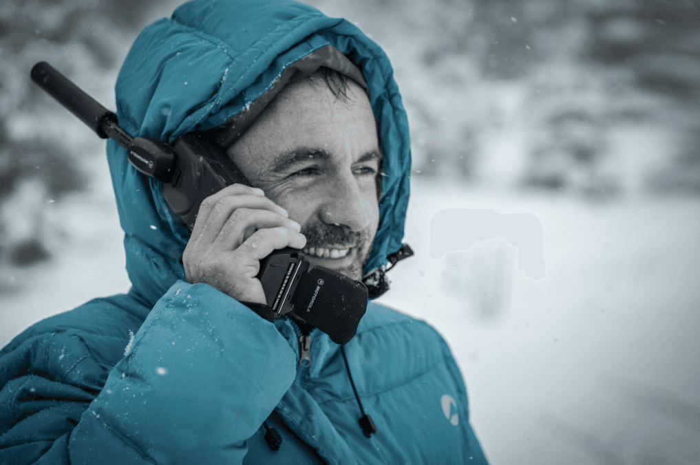
Do satellite phones work everywhere? The short answer is nearly everywhere, but not quite. The slightly longer answer: it depends on the satellite network, whether you have a clear view of the sky, and which device you're using. For most remote hiking destinations, the coverage is genuinely impressive. But "impressive" is not the same as "guaranteed everywhere at all times," and the difference matters when you're injured on a slope at 3,800 metres.
Here's what hikers actually need to know about satellite phone coverage, including where the gaps are and what to do about them.
How Satellite Communication Works
Satellite phones and communicators work by sending signals directly to satellites in orbit rather than to ground-based cell towers. Because satellites orbit above the atmosphere, they can theoretically reach any point on the earth's surface, including open ocean, polar regions, and the middle of uninhabited mountain ranges.
There are two main satellite network architectures used by consumer devices:
Low Earth Orbit (LEO) networks (Iridium, Globalstar): Satellites orbit at 700-1,400km. Faster data, lower latency. Coverage is global for Iridium (which covers both poles). Globalstar has some equatorial gaps.
Geostationary (GEO) networks (Inmarsat, Thuraya): Satellites sit at 35,000km in fixed positions above the equator. Excellent for lower latitudes (most populated land areas), but coverage degrades above approximately 75-80° latitude.
Most hiking-relevant devices (Garmin inReach, SPOT, Zoleo) use LEO networks because of the superior coverage in remote mountain terrain.
Where Satellite Phones Work Well
For the vast majority of hiking destinations, satellite communication works reliably:
Open mountain terrain above treeline: Excellent. Clear sky view in all directions means the strongest possible satellite connection. If you're on a ridge, plateau, or open slope with no overhanging terrain, signal acquisition is fast and reliable.
Open valleys and plains: Good to excellent. Any unobstructed sky view provides reliable coverage.
Desert and coastal terrain: Excellent. No natural obstructions.
High latitude destinations: Iridium-based devices (Garmin inReach, Zoleo) maintain full coverage at both poles. The Alay Valley, Scandinavia, northern Canada, Antarctica: all covered. GEO-based devices (older SPOT models, some Thuraya units) degrade above 70-75° latitude.
Where Signal Can Be Problematic
Despite impressive coverage, three conditions consistently reduce reliability:
Dense Forest Canopy
Trees absorb and scatter satellite signals. In tropical rainforest or dense boreal forest, signal strength drops significantly. You can often still send a message with patience and movement to a clearer patch, but it takes longer and not every attempt succeeds.
Solution: move to the edge of a clearing, a ridgeline, or any gap in the canopy before sending. Don't rely on being able to send from inside dense forest without testing first.
Deep Canyons and Gorges
Steep canyon walls limit your view of the sky to a narrow vertical strip. Depending on the satellite's orbital position at that moment, you may have no line-of-sight to any satellite for minutes at a time. In a deep slot canyon or a steep-sided gorge, this can be a genuine communication problem.
Solution: if you need to communicate from a canyon, climb to a higher point or move to a wider section where more sky is visible. Most canyon walks have exit options.
Overhang and Cave Environments
Any solid overhang blocks the sky view completely. Obviously no satellite signal reaches you inside a cave or under a significant rock overhang.
This is relevant for via ferrata routes with overhanging rock faces, or for seeking shelter under large boulders in a storm.
The Main Devices for Hikers
Garmin inReach Mini 2: Best All-Round Option
The Garmin inReach Mini 2 uses the Iridium network, which provides genuine global coverage including both poles. At 100g it's light enough to forget it's in your pack. Features include two-way text messaging (you can receive as well as send), GPS tracking with a shareable link, weather forecasts, and the Garmin Respond monitoring service for SOS.
The subscription model costs $15-50/month depending on message volume. For frequent travellers, an annual plan reduces the per-month cost. Activating only during trips (seasonal activation at $25) works well for hikers who use it a few times a year.
The two-way messaging is the key feature. With SPOT or basic PLBs, you can only send an SOS. With inReach, you can send updates ("all well, carrying on"), receive weather updates, and have a conversation with rescue services before help is sent. This reduces unnecessary rescues and allows better coordination.
SPOT X: Good Budget Alternative
The SPOT X uses the Globalstar network, which provides good coverage in most hiking areas but has known gaps in some equatorial regions and limited performance above 70° latitude. For most European and North American hiking destinations, the coverage is adequate.
The two-way messaging and GPS tracking work well. The subscription cost is slightly lower than inReach. The primary limitation is the Globalstar network's inferior high-latitude and edge-coverage performance compared to Iridium. If you're hiking in northern Scandinavia, Alaska, or very high-latitude destinations, inReach is the better choice.
Personal Locator Beacons (PLBs): Cheapest Emergency Option
PLBs (such as ACR ResQLINK 400 or McMurdo Fast Find) are one-way SOS devices only. They don't send messages, track location continuously, or allow two-way communication. When activated, they transmit a distress signal to the COSPAS-SARSAT system, which is a government-operated satellite network used by rescue services globally.
PLBs have no subscription fee (one-time registration is free), operate on AAA batteries that last years in standby, and provide global coverage through the government network. They're the right choice if your primary concern is emergency-only signalling at minimal ongoing cost.
The limitation: no two-way communication, no tracking, no non-emergency messaging. For hikers who want full communication capability, inReach is worth the subscription cost. If emergency signalling is all you need on a budget, the cheap personal locator beacons guide compares the main options.
Satellite Communication Options for Hikers
- Garmin inReach Mini 2
Best all-round satellite communicator. Two-way messaging, GPS tracking, SOS, weather forecasts. Iridium global coverage including poles. Subscription from $15/month.
- SPOT X
Budget-friendly two-way messaging with Globalstar network. Good coverage in most hiking areas. Slightly cheaper subscription than inReach. Not ideal above 70° latitude.
- ACR ResQLINK 400 PLB
Emergency-only one-way SOS device. No subscription required. Government COSPAS-SARSAT network with global coverage. The right choice if you only need emergency signalling.
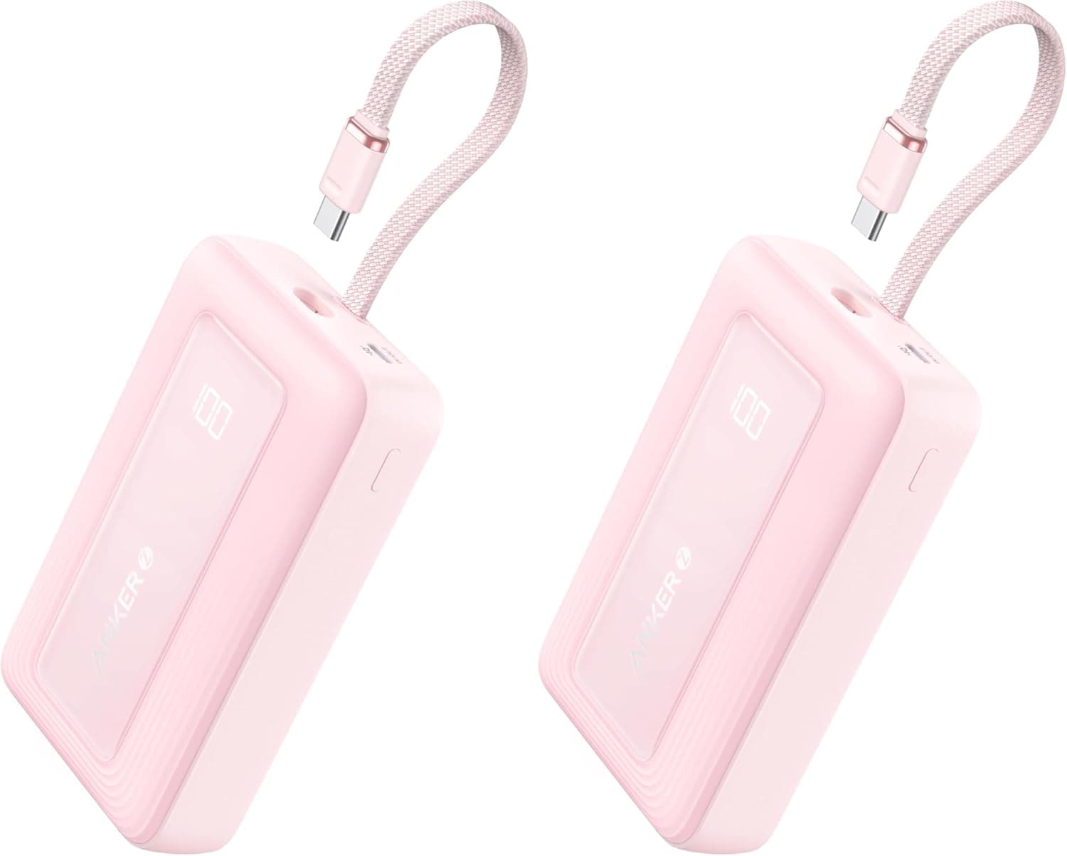
Satellite devices use battery on continuous tracking. This 20,000mAh bank with a built-in cable holds enough charge to top up a communicator many times over a multi-day trip, for around $17.
Satellite Phones vs Satellite Communicators: Which Do Hikers Need?
For most hikers, a satellite communicator (Garmin inReach, SPOT, Zoleo) is more practical than a true satellite phone (Iridium 9555, Thuraya XT).
Satellite phones allow voice calls, which is useful if you need to speak directly with rescue services or family. They're larger, heavier, and more expensive to operate. The monthly plans run $50-100 for basic usage, plus $1-2 per minute for calls.
The case for a satellite phone is strongest for commercial expedition leaders, guides, or anyone who needs extended conversation capability. For recreational hikers, the two-way text messaging of an inReach with a monitored SOS service is functionally superior for emergencies and costs less. If voice calling is a priority for you, the satellite phone for hiking guide breaks down the dedicated handsets.
Can Satellite Devices Replace a Phone on Remote Hikes?
Not entirely. Satellite communicators handle emergency communication and location sharing well. They don't replace a smartphone's offline mapping capability, camera, weather app, or the broader toolkit a phone provides.
The practical setup for remote hiking: a smartphone with offline maps downloaded (maps.me, Gaia GPS, or AllTrails offline) for navigation and general use, and a satellite communicator for emergency communication and weather updates. Keep the phone in airplane mode to save battery. Let the inReach do the location tracking job.
For thorough preparation before a remote hike, the first hike mistakes guide covers navigation prep and why you should always tell someone your route before heading out.
For most hiking destinations, satellite communicators work reliably. The gaps are real but predictable: avoid expecting a signal from deep canyon bottoms or under dense forest canopy, and move to clearer terrain when you need to communicate. An inReach Mini 2 with a basic subscription covers almost every hiking scenario where you genuinely need emergency communication capability.
Last updated on June 21, 2026.

Jasper Baetens
Hiking enthusiast from Belgium, mainly active in Europe. Created HikeHeaven to share experiences, research, tips, tricks and product recommendations, or simply to help other hikers.