I recently went to the Fagaras mountains to go on a ten day hike with a friend of mine and discovered some of the most beautiful hiking trails in Romania. If you are planning to go hiking in the Fagaras mountains any time soon I recommend you to stick around and learn about what trails you should or shouldn’t do.
The Fagaras mountains are located in the Romanian Carpathians and are one of the most beautiful places in Europe to go on a hiking trip. It can be a little bit difficult to map out your personal perfect trail. Everything depends on the amount of distance you want to cover and how many days you would like to spend. Additionally, some people might like the more technical/difficult parts, others might dislike them. This article will give you the needed information to map out your trail. You can read all about how to prepare for hiking in the Fagaras mountains in another article that will cover food, gear, clothes, etc.
Overview
We started our journey without a strict plan, needless to say we made a lot of mistakes. However, we still had one hell of an adventure. Looking back at it, I decided to map out the perfect hiking trail in the Fagaras mountains.
The perfect hiking trail is obviously different for different people. Instead of mapping out one strict trail I will go a little bit broader. I will go over places to sleep, trails to hike, places to avoid, potential difficult parts, etc…So that you can find your own perfect Fagaras hiking trail.
If you want to do the entire ridge at a moderate pace, you have a tent and you don’t want to avoid the more difficult/technical parts, I advise you to check out this website. This is a good documented article about the trail. However, if you want to know more than the basic routes, you don’t have a tent or you want to avoid the technical parts, I suggest that you to read this article.
PS: All the estimated hours are under good weather conditions with a slow to medium pace (resting time not include).
Where to start
Ok so where do you start? I would recommend using the interactive hiking map of welcometoromania, you can find this map by clicking here. This map can be a little overwhelming when you first take a look at it. However, this is a very useful resource if you take your time to examine the map properly.
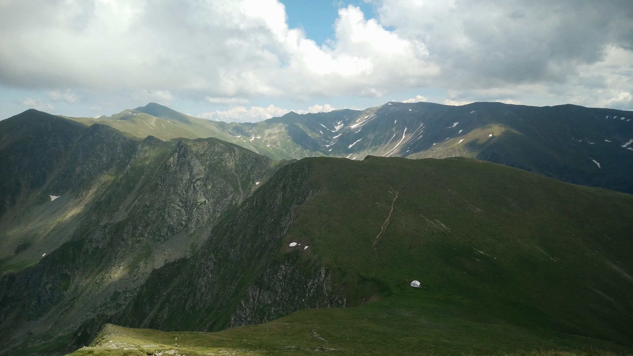
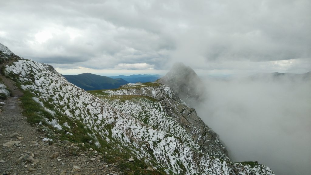
You can clearly see the main ridge horizontally (west to east). Sometimes there are multiple trails that go to the same endpoint. Some of these trails are detours to the closest cabana. Some of these are detours to avoid a difficult part.
You can also see the trails that go vertically, these are the trails that enable you to get to the ridge through a valley. I suggest that you avoid walking any of these valleys on the south side of the ridge. The main reason I say this is because these trails are very long and get very boring after a while. The valleys on the north side are a lot shorter and often more beautiful.
Another thing you will notice is the big road in the middle of the ridge that goes straight through the mountains. This is the Transfagaras road. The only hotel you will encounter while walking the ridge is located next to the road at Balea lake.
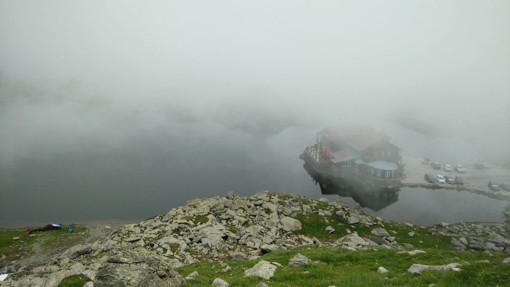
Something to keep in mind is that you can take a cab, a bus or hitchhike back to the closest village at Balea lake. This could be the perfect start or end of your trip if you don’t want to walk the entire ridge.
You will not always have reception so I advise you to download the interactive map on your smartphone. Additionally, you should always have a non digital backup. So make sure to buy or print a map. I printed this map, but make sure you print this on an A3 or an even bigger format.
Where to sleep
Now that we know how to find the trails, it might be a good idea to think about where we can spend the night. You have three options when it comes to sleeping:
- Cabanas: these are manned chalets where you can sleep and eat something. Most of these are located at a lower altitude than the main ridge. If you want to sleep in cabanas you might have to descend from the ridge in the evening and go back up the next morning. This might not sound very appealing, but some of these climbs are very beautiful trails.
- Refuges: these are shelter where you can stay the night. These places are generally not very cozy, but they can offer you shelter from rain and wind during the night. There are no real beds in these shelters, so make sure to bring a sleeping pad and a sleeping bag.
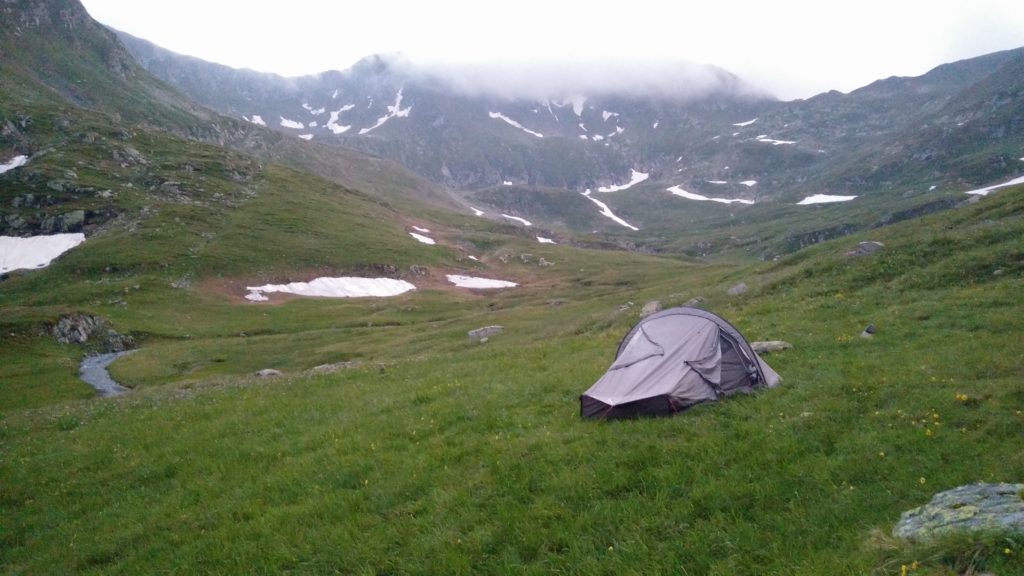
- Tent: there are multiple very nice camping spots you will find along the ridge. Some camping spots are marked on the map, but there are various very nice unmarked camping spots as well.
I would highly recommend that you bring a tent. Not only is it an extremely nice experience to camp in some of these amazing places. It is also a lot safer to have a tent, you can take shelter anywhere at any time. You might be pretty far away from the next shelter when it all of sudden starts storming out of nowhere.
Having a tent can also make your hiking trip so much more comfortable. You don’t have to walk a certain distance every single day. You can go wherever you want, you don’t have to reach the next cabin. Having a tent means having more freedom. Which is very important for me personally.
However, if you don’t want to bring a tent with you, you don’t have to. Just bring a good sleeping pad and a sleeping bag and go from cabana/refuge to cabana/refuge. Even if you plan on only sleeping in the cabanas (where there are beds), still bring a sleeping bag and a sleeping pad just in case you end up spending the night in one of these refuges. It is possible to go from cabana to cabana, but you will often have to cover a big distance. It’s never a bad idea to have a backup plan. Your sleeping bag should be at least 0°-5°.
PS: If you want to be sure to have a bed at the cabana you will have to make a reservation.
Potential trails
So let’s start examining the trails. There are various trails that can take you to the ridge. My recommendations are to either start in Sambetei valley (east side of the ridge) or Sebesu de Sus (west side of the ridge).
If you want to walk the entire ridge, you can simply go up in Sebesu de Sus and go down in Sambetei valley, or the other way around.
As I said before, if you are planning to do a shorter trip, the best thing to do would probably be starting or stopping at Balea lake.
If I had only four days to spend, I would probably start in Sambetei valley and end in Balea lake. You could also do this trail in three or even two days (doing it in two days is rough).
The Sambetei valley is really beautiful, especially when you go at the start of the hiking season. Additionally, this trail comes along some very nice camping spots and you will be able to climb the highest peak in Romania, the Moldoveanu.
The alternative would be to start in Sebesu de sus and go from there to Balea Lake. This is also a very nice route, crossing a lot of the major peaks in Romania. This trail will probably take you three to five days. It’s possible in two days, but once again, that’s rough.
On this trail you can sleep in a bed every night. If you take a look at the map you can see all the marked cabanas. There are also some nice places to camp on this route. As you can see, this trail has some colder areas.
Hiking from Sambetei valley to Balea lake
Day 1
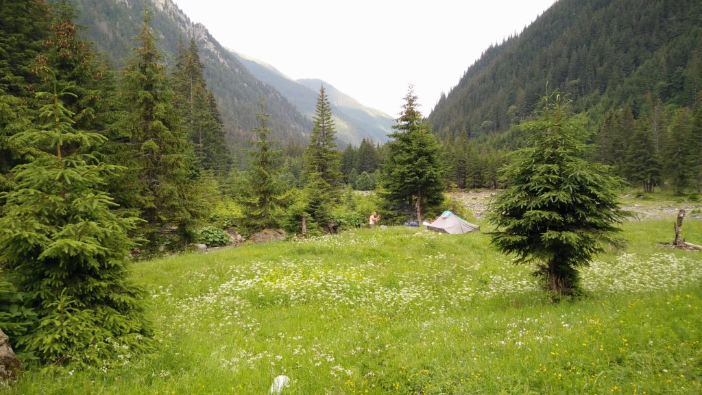
This trail starts at the beginning of the Sambetei valley. You can get there by car. We stayed in Vistisoara on day one and walked from there to the Sambetei valley. It only takes two to three hours to go from the beginning of the valley to Sambetei cabana. This means that if you plan to sleep at the cabana you can take your time to reach Sambetei valley. If you want to spend less than four days, you can skip this sleeping opportunity and continue the trail.
Day 2
Today we start the real climb. We go from the chalet to Fereastra Mare, gaining a height difference of 800 meter in approximately three hours. After this, we can follow the main ridge for two and a half hours before we reach the Vistea refuge hut. Right in front of the Vistea Mare and the Moldoveanu (highest peak in Romania).
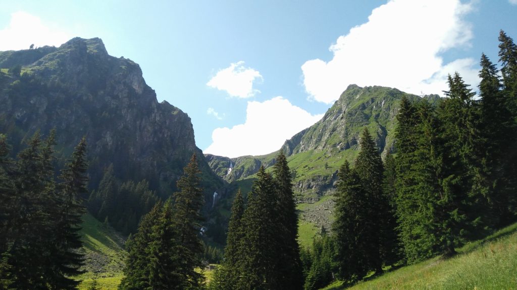
I would recommend bringing a tent on this trail, you will probably only need it for one night, but it’s still worth it in my opinion. It’s definitely not a necessity to bring a tent, but there is an amazing camping spot that I can recommend. If you go down in Rea valley you will notice a stream, this stream evolves into waterfall. Next to the stream, right before the valley’s descend and the waterfall there is an amazing camping spot that I highly recommend.
The walk from the refuge to this camping spot is approximately half an hour. This means that this day you will have hiked around six hours in total.
Note that you can walk from Sambetei valley to cabana Podragu in one day. However, this is approximately ten hour hike, so I would not recommend it to an average hiker.
A nice little camping tip. If you want to fully descend in Rea valley there is a nice little camping place below the treeline as well. It might take another two to three hours to reach this place. You can find the camping place by spotting a deserted hut on the left side (you can spot this while you are walking on the road). If you would do this, I would recommend to rejoin the trail at Pojarna lake (red triangle marking). You can also reach the Moldoveanu from here. Consult the map for more information.
Day 3
The day that we climb the highest peak in Romania, the Moldoveanu. If you camped in Valea Rea you should have been able to spot the Moldoveanu already.
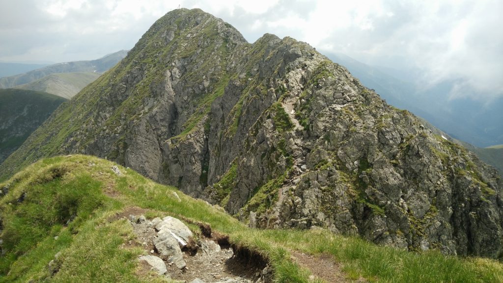
Starting from the refuge, you will very soon start climbing the Vistea Mare. It shouldn’t take you too long to reach the top of this peak. When you reach this peak you will see that the Moldovanu is very close. Going to the Moldoveanu peak is optional, but I highly recommend it.
It probably takes you only fifteen minutes to reach the Moldoveanu peak starting from the Vistea Mare peak. After enjoying the view on the highest mountain in the country, you will have to return to the Vistea Mare and descend on the other side.
From here you will simply follow the trail until you reach cabana Podragu. You will probably have to walk for three hours before you reach the cabana. You can sleep in a bed here or camp at the Podragu lake.
Day 4
The last day of this four day hike will be the hike from Podragu cabana to Balea lake. This hike should take you around six hours.
At Balea lake there are three hotels, you could decide to stay the night there. You could also decide to take a cab/bus or hitchhike back down.
Hiking from Sebesu de Sus to Balea lake
Day 1
The only goal on day one will be to reach cabana Suru. You can walk from Sebes Olt to cabana Suru in four to five hours. If you want you can also let a car drive you to Sebesu de Sus, from here it will only take you three to four hours to reach refuge Suru.
The trail starts a bit boring, but it gets more interesting once you get closer to the refuge. However, it should be said that this is not the most impressive part of the journey.
Day 2
Today we will walk from cabana Suru to cabana Negoiu. This is will be a pretty long and heavy day. It should take you around eight hours before you reach the next cabana.
In this day you will also pass Avrig lake. If you want to spend four days on the ridge instead of three you could decide to camp here. It is definitely a very nice camping spot.
Day 3
On the last day of this trip we will walk from cabana Negoiu to Balea lake. Once again, this will be a pretty heavy trip. It will probably take you around nine hours before you reach Balea Lake.
The day will start with a walk through the forest, followed by a heavy climb of 800 meter. This will probably take you three hours.
The next part is going through the shepherd’s pass. This part is a little bit more difficult, but there are chains that can assist you. After that, you will continue to follow the trail marked by a red cross. Be careful because there can be a lot of snow and ice on this trail.
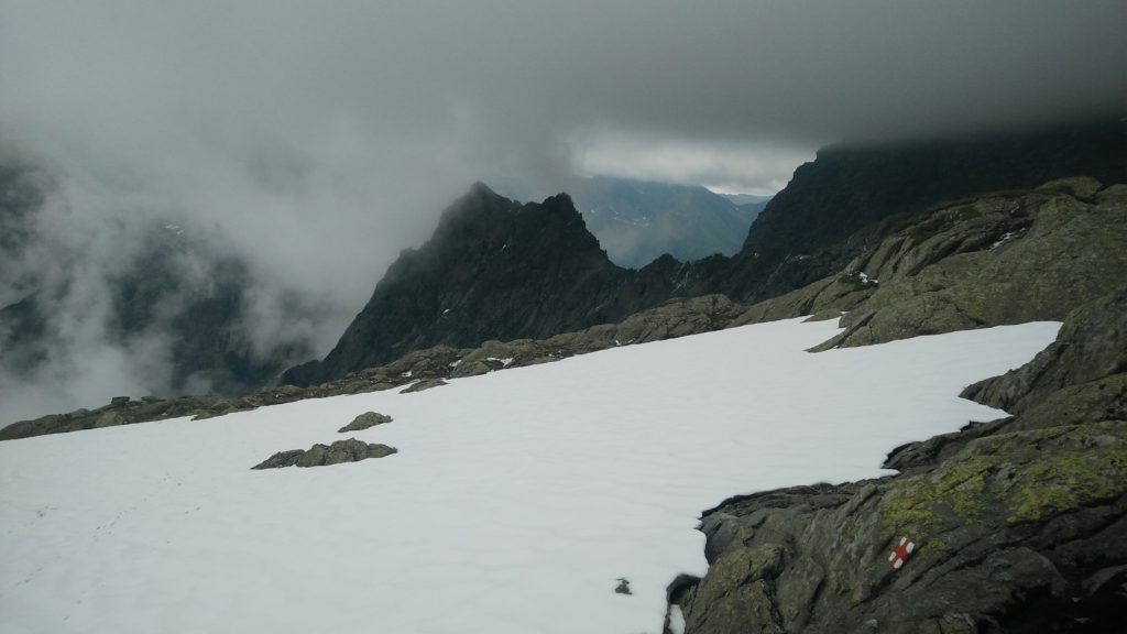
We went there in the end of June and we were the first people in that season to do this trail. Everybody was avoiding this part because it was rather dangerous. I recommend to this in July or August, and bring a cable for additional safety.
If you think this is a little bit too long for you. There are two refuges at Caltun lake where you could stay the night. One of them is rather modern and cozy (there is even electricity). If you take this route, you don’t have to pass cabana Negoiu, you can simply follow the main ridge.
Pay attention for Custura Sarati (between Serbota and Negoiu peak), this is the most difficult and technical part of the entire ridge. You can avoid it by following the marked detour (yellow stripe). Please consult the map for more information. Note that if you go to cabana Negoiu you will not have to go through Custura Sarati.
If you camped at lake Avrig the night before, it will not be possible (for an average hiker) to reach Balea lake on day three.
What to avoid
Let’s quickly summarize what you should avoid in the Fagaras mountains.
- Snow and ice: unless you are prepared for this of course. Snow and ice can occur on marked trails making them a lot more dangerous than usual. Most of the snow should be gone in July and August. However, you can’t be certain.
- Custura Sărăți: You don’t have to avoid this part. A lot of people think this part is a lot of fun. However, I just want to give you a heads up. This is the most technical part of the entire ridge. You don’t need real climbing experience. Everyone should be able to do it, but I can imagine some people would rather avoid this.
- Descending on the south side: If you plan on walking the entire valley on the south side you will probably be very disappointed. This will result in a long boring walk.
- Storms: The weather can be an issue in the mountains. Always try to check the weather and try to avoid heavy rainfall and storms as good as possible. Also note that on a clear day the views at the peaks are a lot more rewarding.
Also make sure to bring proper footwear. Lot’s of information/recommendations can be found on my website. The following articles may be a good starting points for hiking footwear:
Conclusion
The Fagaras mountains provide a lot of very nice marked trails. Navigation in the mountains should not be too hard, most of the trails are well marked.
You do not need climbing experience to hike in these mountains. However, you should be cautious for snow, ice and the weather in general. These might make your journey a lot more dangerous. Be especially careful if you decide to hike outside the season.
You can expect a lot of very nice views, intensive climbs, some beautiful mountains lakes and impressive waterfalls. Don’t expect too many forest trails, you will only encounter trees in the valleys.
I would recommend these mountains to any hiker. Whether you are a beginner or a more experienced hiker, these mountains will not disappoint you.
Now you should have a pretty decent understanding of the trails in the Fagaras mountains. Note that if you need more information about the trails, the people at the cabanas will be able to help you (except maybe at Balea Lake, the people there are generally less helpful than at the other cabanas).
Except for mapping out your trail you should also think about food, gear, clothes, how to deal with bears, etc. I covered all of this in another article how to prepare for hiking in the Fagaras mountains, feel free to check it out. At the very least, make sure to bring a good waterproof hiking jacket.
hello jasper, are the refuges bear-safe? or can bears easily enter? we do not have a bear canister and are worried about sleeping in the refuge with food.
Hi carmel, the refuges are definitely supposed to be bear safe – the ones I passed were all bear safe. FYI, this is a typical unmanned refuge: https://www.welcometoromania.eu/Fagaras/Fagaras_Refugiul_Caltun_e.htm